24 May 2016

Suspect sketch released in Craggy Gardens assault on 64-year-old female hiker found tied to tree

Eleven days after the assault of a 64-year-old female hiker at Craggy Gardens off the Blue Ridge Parkway, National Park Service officials have released a sketch of a suspect, described as a white male, around 50 years old, salt-and-pepper gray hair with an unshaven face.


Park officials with the Blue Ridge Parkway confirmed last week that the woman had been assaulted.

The suspect was said to be wearing a light-colored or faded gray short-sleeve T-shirt, baggy blue pants that appeared old and faded, and dark tennis shoes. He was described as being unkempt and smelled bad, probably from going unbathed.

The hiker, whose service dog was nearby, was taken to an area hospital and released later the same day. She was reported missing by her caregiver and found by emergency personnel who found her tied to a tree near the Craggy Gardens Visitor Center.

Rangers ask anyone with information to call the investigative tip line at 888-653-0009.

19 May 2016

Blue Ridge Parkway officials confirm 64-year-old hiker found tied to tree was assaulted

Park officials with the Blue Ridge Parkway have confirmed that the 64-year-old female hiker found tied to a tree last week near the Craggy Gardens Visitor Center off the Blue Ridge Parkway was assaulted. Neil Labrie, chief ranger for the Blue Ridge Parkway, reported in an email to the Asheville Citizen-Times that an assault did indeed occur. He said all information that was going to be released has been released, according to the Citizen-Times report.
US National Park Service officials at the scene of Craggy Gardens assault. (Photo: News7 WSPA)
 The hiker, whose service dog was nearby, was taken to an area hospital and released later the same day, according to reports. Much of the information about the assault was released as a result of communication between first responders, such as the detail of her being found tied to a tree.

Leesa Brandon, spokeswoman for the National Park Service, said officials have not released further information “in an effort to balance the integrity of this ongoing investigation and the privacy of the people involved,” according to the Citizen-Times.

“While there is an ongoing investigation and a suspect description was released, investigators involved also believed there was no additional threat to public safety and opened the area and all nearby visitor facilities,” she wrote in an email to the Citizen-Times on Monday.

A person of interest in the case is a white male, about 50 years old, with salt-and-pepper hair and partially grown facial hair. He may have been wearing a light-colored or faded gray short-sleeve T-shirt, baggy blue pants that appeared old and faded, and dark tennis shoes. He was said to be unkempt and smelly, possible from going unbathed.


14 May 2016

Park Officials investigating assault of 64-year-old woman found tied to tree while hiking in North Carolina on Mountains to Sea Trail


Buncombe County, NC - Special Agents with the Investigative Services Branch (ISB) of the National Park Service and US Park Rangers of the Blue Ridge Parkway are actively investigating a possible assault that occurred in the area of Craggy Gardens, part of the Mountains to Sea Trail, on Thursday afternoon, May 12.


Rescuers found a 64-year-old female hiker tied to a tree along the Blue Ridge Parkway. (Photo WLOS)
Rangers and other emergency responders conducted a brief search for a hiker that was reportedly missing, and found the 64-year-old woman tied to a tree. She was taken to Mission Hospital for care and her current condition is unknown. Investigators do not have reason to believe this incident was anything other than an isolated event. All visitor facilities in the area remain open.

ABC News 13 WLOS reported that the woman was found near Potato Field Gap, which is less than four miles from the Craggy Gardens Visitor Center in Reems Creek, NC.

The incident began early Thursday afternoon, when the Reems Creek Fire Department responded to a call for a lost person who was possibly having a medical issue, according to a captain with that Weaverville-based agency.

A woman called dispatchers at 1:30 p.m. Thursday, saying she was getting texts from her friend, who was hiking in the area of Snowball Trail at Craggy Gardens.

The 911 caller identified herself as a caregiver for the 64-year-old woman. The caller said she had gotten texts from her friend about changing hiking plans, but then she received messages that the woman was having an emergency. The caller was unsure of the nature of the emergency, but did say the woman has a medical condition.

“She has something that looks like seizures, and when she does, she is conscious long enough sometimes to send a text but generally it renders her somewhat mute,” the caller said in a 911 recording. When crews arrived, they discovered the woman tied to tree. Officials have declined to discuss details of those circumstances.

A rescue worker on the scene told a dispatcher in an emergency radio call, "She's not deceased at this time. She is tied to a tree. This is the one they were looking for."

A person of interest in this case is a white male about 50 years old with salt-and-pepper hair, and he may have partially-grown facial hair. The man was possibly wearing a light-colored or faded gray short-sleeve T-shirt, baggy blue pants that appear old and faded, and dark tennis shoes. He may appear generally unkempt and smell of a musty odor of going unwashed.

If you have any information about the incident, or if you may have noticed someone behaving suspiciously around Craggy Gardens or along the Mountains to Sea Trail between noon and 4:00 p.m. yesterday, please contact the Park Service.

You don't have to tell them who you are, but please tell them what you know:
Call their Tip Line at 888-653-0009
Submit at online Tip
Send a Facebook Message
Email us

07 April 2016

Clinton Magnet Mills Building Catches Fire

The old Magnet Mills building in downtown Clinton caught fire Thursday evening and firefighters from Clinton and Oak Ridge were working to contain it. Clinton Fire Chief Archie Brummitt said they got a call around 7:10 p.m. when a passerby spotted smoke coming from the top of the building.

He said the building has no electricity going to it and fire apparently started in the top floor where there are a variety of things stored like clothes and desks.

Smoke pours out a top floor of the Magnet Mills building while firefighters take a break from fighting the fire.


Oak Ridge Fire Department was using their 100' ladder to spray the top of the building since Clinton's ladder only extends 55', Brummitt said. At about 9:30 Brummitt said they had been unable to make entry to the building and were waiting for it to be cooled down by Oak Ridge. If that didn't work, he said, they will have to tear down part of the building to effectively contain the smoking fire. "We'll probably be here a day or two," Brummitt said.

City crews and police blocked side streets to keep traffic off Hwy. 61 while crews were at the scene. The road was blocked from the intersection of Hwy. 25W and Charles Seivers Blvd. down to near the Highway Patrol office.

Magnet Mills was a knitting mill that opened in 1905 making socks. It employed 1,100 people by the 1930s but closed in the 1960s. It has been unused in recent years except as storage. The 70,000 square foot building sits beside the CVS Pharmacy on Charles Seivers Blvd.

Smoke coming from Magnet Mills building.


17 March 2016

Get your hands dirty by digging in a 16th Century archaeology site, Fort San Juan, in Appalachian Mountains of Western North Carolina


The Exploring Joara Foundation has announced Spring Dig Dates at the Berry Archaeological Site in Morganton, North Carolina. For just $35 per day, you can dig at a unique 16th Century Archaeology Site. For details and exact dates, you can visit exploringjoara.org.

If you don't want to get your hands dirty, you can come for a free public tour from 10 to 12 p.m. on field work Thursdays. Here is the calendar with dig dates listed.

Archaeological.com photo

Original story published in 2013 from University of Michigan's Michigan News:

The remains of the earliest European fort in the interior of what is now the United States were discovered by a team of archaeologists, providing new insight into the start of the U.S. colonial era and the all-too-human reasons spoiling Spanish dreams of gold and glory.

Archaeologists studying a ceremonial mound in a Native American town called Joara discovered an inland fort built by a Spanish expedition in the New World near present-day Morganton, North Carolina (Photo: University of Michigan archaeology)
Spanish Captain Juan Pardo and his men built Fort San Juan in the foothills of the Appalachian Mountains in 1567, nearly 20 years before Sir Walter Raleigh's "lost colony" at Roanoke and 40 years before the Jamestown settlement established England's presence in the region.

"Fort San Juan and six others that together stretched from coastal South Carolina into eastern Tennessee were occupied for less than 18 months before the Native Americans destroyed them, killing all but one of the Spanish soldiers who manned the garrisons," said University of Michigan archaeologist Robin Beck.

Beck, an assistant professor in the U-M Department of Anthropology and assistant curator at the U-M Museum of Anthropology, is working with archaeologists Christopher Rodning of Tulane University and David Moore of Warren Wilson College to excavate the site near the city of Morganton in western North Carolina, nearly 300 miles from the Atlantic Coast.

The Berry site, named in honor of the stewardship of landowners James and the late Pat Berry, is located along a tributary of the Catawba River and was the location of the Native American town of Joara, part of the mound-building Mississippian culture that flourished in the southeastern U.S. between 800 and about 1500 CE.

In 2004, with support from the National Geographic Society and the National Science Foundation, Beck and his colleagues began excavating several of the houses occupied by Spanish soldiers at Joara, where Pardo built Fort San Juan. Pardo named this small colony of Spanish houses Cuenca, after his own hometown in Spain. Yet the remains of the fort itself eluded discovery until last month.
"We have known for more than a decade where the Spanish soldiers were living," Rodning said. "This summer we were trying to learn more about the Mississippian mound at Berry, one that was built by the people of Joara, and instead we discovered part of the fort. For all of us, it was an incredible moment."

Using a combination of large-scale excavations and geophysical techniques like magnetometry, which provides x-ray-like images of what lies below the surface, the archaeologists have now been able to identify sections of the fort's defensive moat or ditch, a likely corner bastion and a graveled surface that formed an entryway to the garrison.

Excavations in the moat conducted in late June reveal it to have been a large V-shaped feature measuring 5.5 feet deep and 15 feet across. Spanish artifacts recovered this summer include iron nails and tacks, Spanish majolica pottery, and an iron clothing hook of the sort used for fastening doublets and attaching sword scabbards to belts.

Fort San Juan was the first and largest of the garrisons that Pardo founded as part of an ambitious effort to colonize the American South. Pedro Menéndez de Avilés, who had established the Spanish colonies of St. Augustine and Santa Elena in 1565 and 1566, respectively, spearheaded this effort. Of the six garrisons that Pardo built, Fort San Juan is the only one to have been discovered by archaeologists.

During the brief time the Spaniards were at Joara, Beck says, they were actively prospecting for gold but never found it. Yet the gold was there: in the early 1800s, American settlers found so much just lying on the surface near rivers that a 17-pound gold nugget was used as a doorstop and a U.S. mint was established in Charlotte, triggering the first gold rush in U.S. history.

Had the people of Joara given Pardo's soldiers more time to discover this gold, Spain would probably have launched a full-scale colonial invasion of the area, England would have had difficulty establishing its foothold at Jamestown, and the entire southeastern part of what is now the U.S. might instead have become part of Latin America.

Why did the Mississipians wipe the Spaniards out so quickly? Beck and colleagues argue that originally, the Spanish bartered with the natives for food.

"The soldiers believed that when their gifts were accepted, it meant that the native people were their subjects," Beck said. "But to the natives, it was simply an exchange. When the soldiers ran out of gifts, they expected the natives to keep on feeding them. By that time, they had also committed what Spanish documents refer to as "indiscretions" with native women, which may have been another reason that native men decided they had to go. So food and sex were probably two of the main reasons for destroying Spanish settlements and forts."

Moore said the significance of Fort San Juan extends far beyond the Carolina Piedmont.
"The events at Fort San Juan represent a microcosm of the colonial experience across the continent," he said. "Spain's failure created an opening that England exploited at Jamestown in 1607, when America's familiar frontier narrative begins. For Native Americans, though, this was the beginning of a long-term and often tragic reshaping of their precolonial world."

From the University of Michigan's Michigan News

20 January 2016

German artist's sketches give first-hand view of "strange new world" in 1700s; include now-extinct species, some species not known to Georgia Coast, and Uchee Indians and their dwellings

Do you ever run across a nugget of historical significance that just excites you beyond belief?

I was doing some research today and I found something so intriguing I just had to share it. I love history and when I hear something I've never heard before it's exciting, and this find doesn't involve just an awesome story, but also sketches from the 1730s of plants and animals, some now extinct, native Indians and their dwellings and much more along the coast of Georgia ... drawings that are first-hand and intricately detailed.

Yuchee Indians going hunting. © Det Kongelige Bibliotek
It seems that in 1736, a 25-year-old German named Philip Georg Friedrich von Reck sailed to America from Germany with a group of colonists. He wanted to bring back "ocular proof," he wrote, of "this strange new world."

Lucky for us, he was a gifted and super-talented artist and his watercolor and pen and pencil sketches are among the first known of many plants, animals and species ... some of which are now extinct and weren't known to even exist on the coast of Georgia.

Wild American Pigeon. © Det Kongelige Bibliotek

He captured for posterity a glimpse of the first European settlers to Georgia, their day-to-day life, what they saw, what they ate, plants that grew in the region, birds that sang in the branches of their trees, native Uchee Indians, their dwellings, their boats, the fish in the ocean ... what a gift for the ages to art, science and history.

I ran across this information on the People of One Fire blog here. Blog author Richard Thornton drops this bombshell: "Native Americans near the Georgia Coast grew calabaza (tropical) squash, watermelons, passion fruit, pineapples and cacao, from which chocolate is made. This has been completely left out of the textbooks, but would explain why chocolate was detected in beakers unearthed at Cahokia."


Cocoa nut and leaf. © Det Kongelige Bibliotek
Cahokia Mounds, the largest pre-Columbian site north of Mexico, are in Illinois and are the remains of a forgotten Indian city. Of its 4,000 acres, 2,200 acres are preserved as a state historic site. You can read an interesting article about the mounds in National Geographic here. Clay beaker vessels found at Cahokia were analyzed and found to contain residue of "black drink," a caffeinated tea-like beverage six times more potent than coffee and possibly containing a compound found in cacao but definitely made from a species of holly.

Thornton is a professional architect, city planner, author and museum exhibit designer and builder. He is considered one of the nation's leading experts on Southeastern Indians.

Yuchee Indian war dance. © Det Kongelige Bibliotek
On the website of the Savannah River Band of the Uchean Indian Tribe, it tells of the origins of this tribe, which has lived along the Savannah River since the 1500s. They were one of several ethnic groups in the Old Apalache Kingdom.

You can read more about the Ucheans here.

Thornton said this was a distinct branch of the Uchee, different from their neighbors in that the Tennessee Valley Uchee only built round houses and villages and the Savannah Uchee villages had a Caribbean feel to their architecture.

And there is among Von Reck's sketches the only known drawing of a fort built on the Savannah River in the early 1700s.

Military fort on Savannah River. © Det Kongelige Bibliotek

Waterspout, top, and pelican and crocodile, bottom. © Det Kongelige Bibliotek

Von Reck's sketch book is now owned by Det Dansk Kongelige Bibliotek (the Danish Royal Library) and can be accessed here.  You can scroll through each page of the sketch book and view these amazing glimpses of life as he saw and experienced it 280 years ago.


15 January 2016

Smokies Centennial Challenge - Hike 100

Hike 100 Pin
Program Overview
This year we are celebrating the Centennial of the National Park Service. To honor the first 100 years of the National Park Service and launch into the next century, the Park Superintendent has committed to hiking 100 miles of park trails during 2016 -- and he invites you to join in on this challenge!

Whether you are new to hiking in the Smokies or have seen most or all the trails in the park before, we encourage you to set a goal of reaching 100 miles during this special year of celebration, between January 1-December 6, 2016. You may hike any 100 miles of maintained trails in the park. Your miles can include everything from front country nature trails to the extensive trail network in the backcountry. You may hike the same trail repeatedly or different trails; and you may hike them solo, with a group or even with a guide. The goal is to inspire you to explore and enjoy the many benefits the park has to offer. More information.

Explore the park website for information about hiking safety, trail recommendations, weather, road and trail closures, and the park's trail map. If you plan to include overnight trips in your hiking plan, be sure to obtain a reservation and permit for all overnight stays in the backcountry.
When you are ready to take on this challenge, plan your hikes and get out on a trail! Download a mileage log that you may use to keep track of your miles. Or, you can purchase one from the Great Smoky Mountains Association here for $1.00.

After you have hiked 100 miles this year, send an email to let us know! You will then receive information about the Hike 100 Celebration on Thursday, December 8, 2016 to receive your commemorative "Smokies Centennial Challenge - Hike 100" pin!
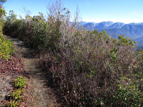
Brushy Mountain
Sample 100 Mile Hike Plan
Gatlinburg Trail - 4 miles
Little River & Cucumber Gap Trails Loop - 6 miles
Chimney Tops Trail - 4 miles
Porters Creek Trail - 8 miles
Ramsay Cascades - 8 miles
Abrams Falls Trail to the Falls - 6 miles
Gregory Bald Trail to the Bald - 9 miles
Trillium Gap Trail to Grotto Falls - 3 miles
Laurel Falls Trail - 3 miles
Forney Ridge Trail to Andrews Bald - 5 miles
Big Creek Trail to Mouse Creek Falls - 5 miles
Smokemont Loop Trail - 7 miles
Noland Divide to Lonesome Pine Overloop - 7 miles
Deep Creek & Sunkota Ridge Loop - 13 miles
Cataloochee Divide Trail - 10 miles
Oconaluftee River Trail - 3 miles

Any 100 miles count! Superintendent Cash's 100 Mile Plan is subject to change due to all kinds of factors - like weather, trail conditions, and fitness level of those who hike with him. The important part is that the miles he will cover by the end of the year will be 100.
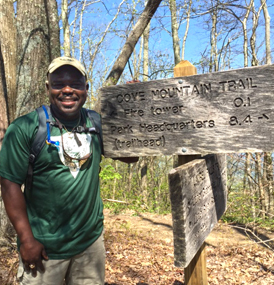
Park Superintendent on Cove Mountain Trail
Hike Events with the Superintendent
In the spirit of the Centennial, many of Superintendent Cash's hikes will be with youth who may be experiencing their first such adventure in the park. There are also public events which will give you the opportunity to hike alongside the Superintendent. These include two front country hikes that are open to anyone who would like to attend and two backcountry hikes which are each limited to 20 hikers. This limit is due to our concern for the resources in the backountry, our attention to Leave No Trace and hiker safety. To reserve a space on one of these backcounty hikes, send us an email and we will contact you with further information.

Front country Hikes, Open to Everyone
:
Saturday, August 20, 2016 - Gatlinburg Trail
Saturday, December 3, 2016 - Oconaluftee River Trail
* Check back for more details about these hikes *

Backcountry Hikes, Limited to a maximum of 20 hikers each:
Saturday, June 25, 2016 - a trail in North Carolina
Saturday, October 8, 2016 - a trail in Tennessee
* Email us if you are interested in a spot *
Latest Trail Adventures
Check here throughout the year to see pictures and read about some of the latest trails that Superintendent Cash has explored. You might see something you will want to add to your list!
Share your thoughts
We welcome you to share your comments and reflections about your hiking experiences as you cover your 100 miles. Email your thoughts to Superintendent Cash and he will reply to some of your messages throughout the year. You can also share you photos and reflections on Facebook at www.facebook.com/GreatSmokyMountainsNPS in the "visitor posts" section and/or on your own Facebook, Twitter or Instagram accounts and tag it with #Hike100. 

31 August 2015

Smokies hiker Jenny Bennett's cause of death announced; Memorial hike planned

Great Smoky Mountains National Park officials received the final autopsy report from the
Sevier County Medical Examiner’s Office for Susan J. "Jenny" Bennett, of Sylva,
NC and have concluded that her cause of death was environmental hypothermia.

Bennett was reported missing and discovered off trail by rangers in the Greenbrier area
of the park above backcountry campsite 31 on June 8. The report concludes that Bennett
died of environmental hypothermia due to cold exposure from partial submersion in Porter’s
Creek.
Jenny Bennett hiking in the Smokies.

However, she did have a toxic level of diphenhydramine concentration in her blood, which is considered a significant contributing factor in her death and points toward an intentional overdose, according to the Medical Examiner's Office. Diphenhydramine is used to treat common colds and allergies.

Bennett was found in a sitting position in the creek with her head resting on rocks. According to the final autopsy report, she had bruises on her right hip and elbow consistent with a fall. However, she did not have any internal or musculoskeletal trauma.

Bennett, age 62, was an avid hiker in the Smoky Mountains and maintained a blog about her trips. She had been a member of the Smoky Mountain Hiking Club and often liked to hike off trail in the park. She was also a published author and blogger. One of her older blog sites, jennybennett.net, chronicles her off-trail hiking adventures in the Smokies, and a more recent publication was her hiking blog Endless Streams and Forests. She published a murder mystery, Murder at the Jump Off, set in the Smokies, and a contemporary fiction novel, The Twelve Streams of Leconte.

Her brother Peter Bennett, of Bozeman, Montana, who originally reported his sister missing, had this to say about her death on her Endless Streams and Forests blog:

"Jenny was planning on moving to Vermont to be closer to her sister Betsy at the beginning of June. She had packed most of her belongings and must have decided to make one last hike to her favorite area of the Smokies. She went up Porter’s Creek (setting for her first novel, Murder at the Jumpoff) and never returned. It was about a week before her landlord went to the house she was renting and realized that she had never left. He called me (Peter) and we were both very concerned. A search was launched, her car was found at the Porter’s Creek trailhead, and her body was found the next morning."

He continued, "Details of what actually happened to Jenny are unclear. The Park Service launched an investigation after her body was found, but they still don’t know everything. It is likely that we will never really know what happened. We do know that Jenny died in her favorite place in the world, the beautiful Smoky Mountains."

Her obituary in the Knoxville News-Sentinel gave a moving glimpse into her life.

"Jenny has always had an adventurous spirit and hitchhiked across Europe when she was 18. She went to college at New College in Sarasota, Florida, where she received a Bachelors degree in philosophy. She was also very interested in writing and editing, and earned a Masters degree in creative writing a few years later. In 1980 Jenny married Chris Hebb. They moved to Knoxville, where Chris went to school at the University of Tennessee. While living in Knoxville, Jenny was employed as a writer for a journal about the coal market. It was during this period that she began hiking in the Smoky Mountains and joined the Smoky Mountains Hiking Club. A few years later Jenny divorced Chris and she moved north to Gloucester Massachusetts."

"She spent many years exploring the White Mountains in New England with her dear friend, Bob Parlee. Her accomplishments included summiting all of the highest mountains of New England in summer and winter. Jenny traveled to many locations all around the world. She frequently summited the highest point wherever she traveled. In 2009, Jenny returned to the Smoky Mountains and lived in North Carolina. Her many off trail adventures in the Smokies are well known to her family, friends, and members of the Smoky Mountains Hiking Club."

Memorial Hike planned Sept. 13 by Smoky Mountains Hiking Club

The Smoky Mountains Hiking Club has announced a memorial hike for Jenny on Sept. 13, 2015, on the Porters Creek Trail, with a potluck lunch of fellowship and reflection at the Porters Creek Pavilion. Times and details to be announced as they are confirmed with information on their website, www.smhclub.org.


10 June 2015

Authorities positively identify hiker as Jenny Bennett, friends start memorial wall on GoSmokies

Great Smoky Mountains National Park officials have positively identified the body found in the Greenbrier area of the Great Smokies as that of 62-year-old Jenny Bennett of Sylva, NC. She was reported missing by her brother Peter Bennett of Bozeman, Montana when she wasn't at home on the day she was supposed to be moved to Vermont.
Jenny Bennett (from her blog)

He believed she had been on a final hike before leaving on May 30 or 31. Movers were supposed to show up on June 1 and her landlord called her brother on Saturday, June 6, when she was officially reported missing.

Bennett was an avid off-trail hiker in the Smokies and was also a published author and blogger. One of her older blog sites is jennybennett.net, where she chronicled her off-trail hiking adventures in the Smokies, and more recently she published the hiking blog Endless Streams and Forests. She published a murder mystery, Murder at the Jump Off, set in the Smokies, and a contemporary fiction novel, The Twelve Streams of Leconte.

GSMNP Spokesperson Dana Soehn reported that there is currently no suspicion of foul play and said there were no obvious signs of animal attack. Bennett's vehicle was found at the Porters Flats trailhead Sunday night and her body was found about 9:30 Monday morning about a half-mile above backcountry campsite 31 off-trail following an intensive search. Her cause of death has not yet been released.

Bennett was a member of the Smoky Mountain Hiking Club and also an avid contributor to the GoSmokies blog site, where shortly before she went missing her posts were deleted. Her hiking friends have started a memorial site there to honor their friend and fellow hiker, Remembering Jenny Bennett.

You can read earlier reports on her disappearance by scrolling down to previous blog posts as events unfolded.

08 June 2015

UPDATE: Mother and 16-year-old son missing in Clingmans Dome area of Smokies found at 2 p.m. today

UPDATE: Rangers at Great Smoky Mountains National Park have found a missing woman and her son from Fond Du Lac, Wisconsin who had been reported being lost in the park on Sunday, June 7.

Christy Barns, 40, and her son, Casey, 16, had sent a text message to family members on Sunday evening at 8:38 p.m. stating they were lost and needed help. Rangers were notified and were able to locate the individuals’ vehicle at Clingmans Dome. The ground search was initiated on Monday morning and the pair was soon found in good condition along the Forney Ridge trail a little before 2:00 p.m.

The park had mobilized an incident management team and deployed search teams to the trails surrounding Clingmans Dome. The search involved 30 National Park Services employees with 15 of those actively searching in the field. The initial search focused on trails which carried the highest probability of where the pair may have been located. 

We reported earlier:
A search is underway for a mother and her 16-year-old son from Wisconsin, who are missing in the Great Smoky Mountains National Park near the Clingmans Dome area. Dana Soehn, spokesperson for the Great Smoky Mountains National Park, said officials believe the pair was day hiking but that no other information is available.

They were reported missing Sunday night at 8:30 p.m. when they didn't return from their hike. The search for the missing hikers began Monday morning. More details will hopefully be known later today, Soehn said. These hikers are not to be confused with hikers lost Saturday in the Roaring Fork area who were reunited with their party.


At 6,643 feet, Clingmans Dome is the Great Smoky Mountains National Park's highest point. It is the highest point in Tennessee and the second highest point east of the Mississippi. It's a popular Park destination and is located in both North Carolina and Tennessee. The peak is accessible after driving Clingmans Dome Road from Newfound Gap, and then walking a steep half-mile trail. A paved trail leads to a 54-foot observation tower. The Appalachian Trail crosses Clingmans Dome, marking the highest point along its 2,144-mile journey.